Sort Score
Result 10 results
Languages All
Labels All
Results 131 - 140 of 8,495 for

geometry

(0.09 sec)
  1. mesh.png

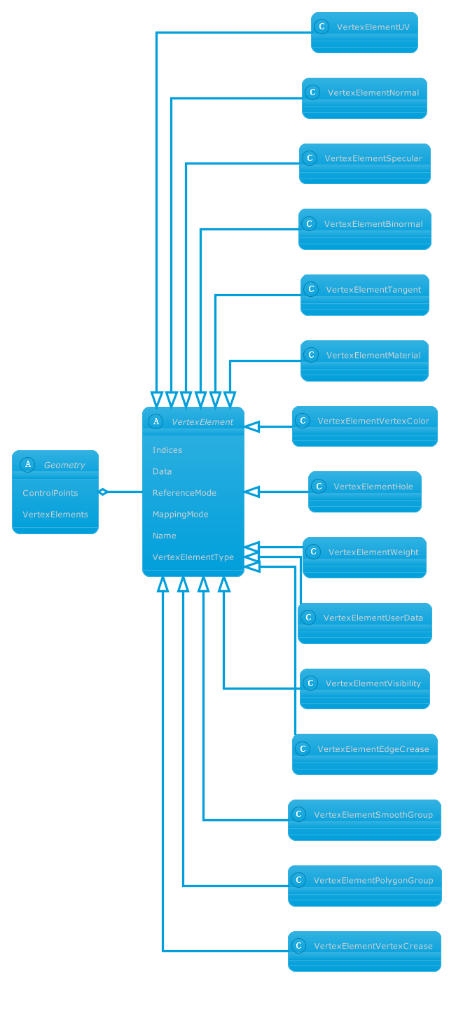
    nonpremultipled deflate 1474 8 8 8 8 PixelInterleaved width=641, height=1474, bitDepth=8, colorType=RGBAlpha, compressionMethod=deflate, filterMethod=adaptive, interlaceMethod=none RGB 8 8 8 8 1474......Vertex elements in Geometry classes abstract Geometry { ControlPoints...class VertexElementVertexC } Geometry o-- VertexElement VertexElement...
    docs.aspose.com/3d/fr/python-net/aspose-3d-docu...
  2. Bug 5124: Converting MapInfoTab to Shapefile- C...

    Hi Alexander, I forgot to report on this bug. Please see: Test data(input/output/QGIS) 5124 MapInfoTab to Shapefile.zip (13.3 KB) Thanks,...generated Shapefile contains valid geometry but the attribute table is...calling ReadAll() first, so only geometry was materialised. Recommended...

    forum.aspose.com/t/bug-5124-converting-mapinfot...
  3. Generate Point Cloud to OBJ File Formats via Ja...

    Sample Java generate point cloud code for OBJ file. Use this example code to generate point cloud to OBJ file within any Web or Desktop Java based application....(entity instanceof Geometry){ Geometry g= (Geometry) entity; Merge(pc...void Merge(PointCloud pc, Geometry g, Matrix4 transform) { PointCloud...

    products.aspose.com/3d/java/point-cloud/obj/
  4. Bug 5331: Converting CSV to GeoPackage- Convers...

    Hi Alexander, I moved to new version 26.5 and here my results: Please see: Comparison(left-Csv, right-GeoPackage) image.png (173.1 KB) image.png (164.8 KB) Test data(input/output/QGIS) 5331-Csv-GeoPacakge.zip (3…...GeoPackage contains no valid geometry (the mygeodata layer is reported...GIS expects a column named Geometry (or a WKT/EWKB column) or...

    forum.aspose.com/t/bug-5331-converting-csv-to-g...
  5. Change Adjustment Values of the Shape with Java...

    Learn how to change adjustment values of shapes in Excel using Aspose.Cells for JavaScript via C++....geometry property to make changes to...will explain the use of Shape.geometry property to change the adjustment...

    docs.aspose.com/cells/javascript-cpp/change-adj...
  6. Bug 5125: MafInfoTab to TopoJson- Conversion su...

    Hi Alexander, Please see: Test data: 5125 -MapInfoTab -Csv.zip (9.9 KB) How do I open MafInfoTab to see its content , to compare to Csv that skip Geometry? Thanks,...to compare to Csv that skip geometry? Thanks, Alexander.Matveev...to compare to Csv that skip geometry? To see attributes value you...

    forum.aspose.com/t/bug-5125-mafinfotab-to-topoj...
  7. Upgrade GIS.Lib to 26.2.0 - Free Support Forum ...

    Hu Alexander, I run all my tests ( 896) that covers all conversions of your formats. It seems that everything is OK. Is it ? [esrijson1] Testing EsriJson → Gdb Args: input=‘D:\GisConverter\Tests\EsriJson\Input\esrijs…...error: FileGDB does not allow geometries of different types into same...GpxDriver does not support Polygon geometry type Result: ConversionFailed...

    forum.aspose.com/t/upgrade-gis-lib-to-26-2-0/32...
  8. 4571 -Kmz ->Topojson -Results does not see in Q...

    Hi Alexander, Kmz ->Topojson Results does not see in QGIS, conversion succeeded. Link to screencast: https://app.screencast.com/etcR3d4wLzH7k Attached samples: input/output/QGIS. Bug 4571 KMZ to TopoJson -results d…...format does not support 3D geometry, but input Kmz have LineStringZ...format does not support 3D geometry and we will not support too...

    forum.aspose.com/t/4571-kmz-topojson-results-do...
  9. Kmz to Gml -> results are empty via QGIS and co...

    Hi Alexander, **Kmz to Gml ** results are empty via QGIS and conversion succeeded Link to screencast: Attached samples: input/output/QGIS. Bug 4570 Kmz to Gml - result in empty via QGIS and conversion succeeded.zip …...workaround you can force the geometry type during conversion: using...Aspose.Gis; using Aspose.Gis.Geometries; using Aspose.Gis.Converters;...

    forum.aspose.com/t/kmz-to-gml-results-are-empty...
  10. GIS Data Manipulation APIs for .NET | products....

    Create, read, convert, process GIS data and render maps though library designed specifically for .NET developers....Surfaces Build Non-Linear Geometries Translate to WKT and WKB...a Buffer Region Validate Geometries Convert Data Between Formats...

    products.aspose.com/gis/net/