Sort Score
Result 10 results
Languages All
Labels All
Results 5,561 - 5,570 of 6,389 for

database

(0.11 sec)
  1. Pisah PDF Dadi Bagean Python

    Pisah PDF file menyang kaca kanthi nggunakake Python kode. Simpen PDF minangka file kapisah nggunakake Python....menyang sistem informasi utawa database otomatis, solusi mandiri kanggo...

    products.aspose.com/words/jv/python-net/split/pdf/
  2. Opdel TXT I Dele Python

    Opdel TXT filer i e sider ved hjælp af Python koden. Gem TXT som separate filer ved hjælp af Python....informationssystemer eller databaser. Vores bibliotek giver Python-udviklere...

    products.aspose.com/words/da/python-net/split/txt/
  3. Opdel DOCX I Dele Javascript

    Opdel DOCX filer i e sider ved hjælp af JavaScript koden. Gem DOCX som separate filer ved hjælp af JavaScript....informationssystemer eller databaser. Vores bibliotek giver JavaScript-udviklere...

    products.aspose.com/words/da/nodejs-net/split/d...
  4. Витягніть текст і зображення з файлу Excel в Ін...

    Інтернет-додаток аналізатора файлів Excel. Код .NET API C# для вилучення тексту в рядках і комірках з електронних таблиць Excel....xlsx files into databases, applications, or APIs. Migrating...

    products.aspose.com/total/uk/net/parse/excel/
  5. Extraheer tekst en afbeeldingen uit het PDF-bes...

    Online PDF-bestandsparser-app. .NET API C#-code om afbeeldingen en tekst uit het PDF-document te extraheren....formulieren en facturen om databases of boekhoudsystemen automatisch...

    products.aspose.com/total/nl/net/parse/pdf/
  6. Bekijk en update Excel-eigenschappen online of ...

    Bekijk en wijzig Excel-eigenschappen gratis via de online app. C# .NET API-code om Excel-eigenschappen bij te werken en toe te voegen....externe systemen zoals ERPs of databases via metagegevens. Gebruik...

    products.aspose.com/total/nl/net/metadata/excel/
  7. Cập nhật Aspose.GIS: Chỉnh sửa các đối tượng và...

    Bài viết này khám phá những cải tiến gần đây trong thư viện Aspose.GIS, tập trung vào khả năng mới để phát hiện và lưu các thay đổi hình học trong một ứng dụng bản đồ....1;Username=gis;Password=password;Database=Hungary" )) { var dataSource...1;Username=gis;Password=password;Database=Hungary" ); await conn . OpenAsync...

    docs.aspose.com/gis/vi/net/showcases/saving-cha...
  8. API OCR rapida e affidabile basata su Aspose.oc...

    Integra perfettamente il riconoscimento dei caratteri ottici (OCR) nelle tue applicazioni Python usando Aspose.ocr per Python tramite Java....essere salvati, importati in un database o analizzati in tempo reale...salvato automaticamente nel database o verificato automaticamente...

    products.aspose.com/ocr/it/python-java/
  9. mesh.png

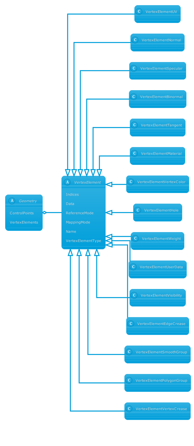
    nonpremultipled deflate 1474 8 8 8 8 PixelInterleaved width=641, height=1474, bitDepth=8, colorType=RGBAlpha, compressionMethod=deflate, filterMethod=adaptive, interlaceMethod=none RGB 8 8 8 8 1474......FontColor #009fdb } skinparam database { FontColor #fff BorderColor...FontColor #009fdb } skinparam database { FontColor #fff BorderColor...

    docs.aspose.com/3d/ru/python-net/aspose-3d-docu...
  10. RAW with geotagging

    RAW files are unprocessed image files that contain raw sensor data captured by a digital camera. These files are known for their high-quality and flexibility in post-processing. When combined with geotagging, RAW files can be enhanced with accurate geolocation metadata, such as latitude and longitude coordinates. Geotagging RAW files provides valuable context and enables photographers to document the exact location where the photo was taken. It enhances organization, storytelling, and makes it easier to search and discover images based on location. Geotagging RAW files is particularly useful for travel photography, outdoor adventures, scientific research, and any projects that require precise location data....create comprehensive visual databases, contribute to mapping efforts...
    products.aspose.com/gis/net/geotag-photo/raw/