Sort Score
Result 10 results
Languages All
Labels All
Results 891 - 900 of 8,458 for

geometries

(0.14 sec)
  1. mesh.png

    nonpremultipled deflate 1474 8 8 8 8 PixelInterleaved width=641, height=1474, bitDepth=8, colorType=RGBAlpha, compressionMethod=deflate, filterMethod=adaptive, interlaceMethod=none RGB 8 8 8 8 1474......Vertex elements in Geometry classes abstract Geometry { ControlPoints...class VertexElementVertexC } Geometry o-- VertexElement VertexElement...

    docs.aspose.com/3d/tr/python-net/aspose-3d-docu...
  2. mesh.png

    nonpremultipled deflate 1474 8 8 8 8 PixelInterleaved width=641, height=1474, bitDepth=8, colorType=RGBAlpha, compressionMethod=deflate, filterMethod=adaptive, interlaceMethod=none RGB 8 8 8 8 1474......Vertex elements in Geometry classes abstract Geometry { ControlPoints...class VertexElementVertexC } Geometry o-- VertexElement VertexElement...

    docs.aspose.com/3d/ar/java/aspose-3d-document-o...
  3. mesh.png

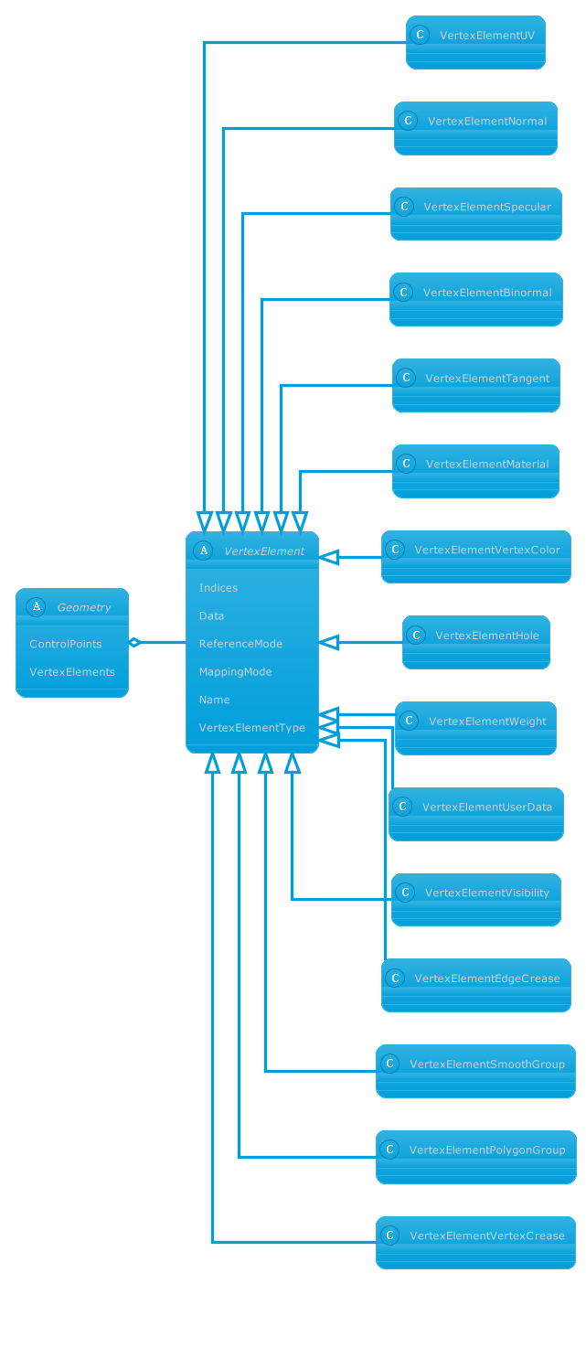
    nonpremultipled deflate 1474 8 8 8 8 PixelInterleaved width=641, height=1474, bitDepth=8, colorType=RGBAlpha, compressionMethod=deflate, filterMethod=adaptive, interlaceMethod=none RGB 8 8 8 8 1474......Vertex elements in Geometry classes abstract Geometry { ControlPoints...class VertexElementVertexC } Geometry o-- VertexElement VertexElement...
    docs.aspose.com/3d/ru/java/aspose-3d-document-o...
  4. Can I Process GeoJSON file using this API for f...

    Hi, can we use Aspose.gis for working with Geojson files?...WriteLine($"Geometry Type: {feature.Geometry.Type}"); // Access...print out the feature IDs, geometry types, and properties. You...

    forum.aspose.com/t/can-i-process-geojson-file-u...
  5. Изменение значений коррекции формы|Documentation

    В этой статье показано, как изменить значения корректировки формы с помощью API Aspose.Cells для Python via .NET....geometry.shape_adjust_values для внесения...использование свойства Shape.geometry.shape_adjust_values для изменения...

    docs.aspose.com/cells/ru/python-net/change-adju...
  6. Changer les valeurs d ajustement de la forme av...

    Apprenez comment modifier les valeurs d ajustement des formes dans Excel en utilisant Aspose.Cells for JavaScript via C++....geometry pour apporter des modifications...l’utilisation de la propriété Shape.geometry pour changer la valeur d’ajustement...

    docs.aspose.com/cells/fr/javascript-cpp/change-...
  7. Generate Point Cloud to AMF File Formats via Ja...

    Sample Java generate point cloud code for AMF file. Use this example code to generate point cloud to AMF file within any Web or Desktop Java based application....(entity instanceof Geometry){ Geometry g= (Geometry) entity; Merge(pc...void Merge(PointCloud pc, Geometry g, Matrix4 transform) { PointCloud...

    products.aspose.com/3d/java/point-cloud/amf/
  8. Generate Point Cloud to STL File Formats via Ja...

    Sample Java generate point cloud code for STL file. Use this example code to generate point cloud to STL file within any Web or Desktop Java based application....(entity instanceof Geometry){ Geometry g= (Geometry) entity; Merge(pc...void Merge(PointCloud pc, Geometry g, Matrix4 transform) { PointCloud...

    products.aspose.com/3d/java/point-cloud/stl/
  9. mesh.png

    nonpremultipled deflate 1474 8 8 8 8 PixelInterleaved width=641, height=1474, bitDepth=8, colorType=RGBAlpha, compressionMethod=deflate, filterMethod=adaptive, interlaceMethod=none RGB 8 8 8 8 1474......Vertex elements in Geometry classes abstract Geometry { ControlPoints...class VertexElementVertexC } Geometry o-- VertexElement VertexElement...

    docs.aspose.com/3d/tr/java/aspose-3d-document-o...
  10. Bug 5392- GeoJson to GeoJson/EsriJson/Gdb/GeoJs...

    Hi Alexander, [geojson10] Testing GeoJson → GeoJson Args: input=‘D:\GisConverter\Tests\GeoJson\Input\geojson4.7z’, format=‘GeoJson’, output=‘D:\GisConverter\Tests\GeoJson\Output\2026-06-08_14-38-55\geojson10\GeoJson’, t…...Geometries; using Aspose.Gis.Formats;...---------- // 1. Helper: check if a geometry contains NaN/Infinity bool...

    forum.aspose.com/t/bug-5392-geojson-to-geojson-...